


Precise trade area
Time/distance isochrones, major attractors (shopping centers, transit), and physical barriers factored in.
Because behind every address, there is an opportunity to seize or a risk to avoid.
Every successful location decision rests on four dimensions. Magellan collects and interprets them for you, you keep the decision, not the analysis workload.
Time/distance isochrones, major attractors (shopping centers, transit), and physical barriers factored in.

Population, income, and consumer profiles cross-referenced with your target customer.

Your network, direct competitors, and indirect alternatives on a single map.

Passing volume, hourly and seasonal peaks, measured at the exact address.

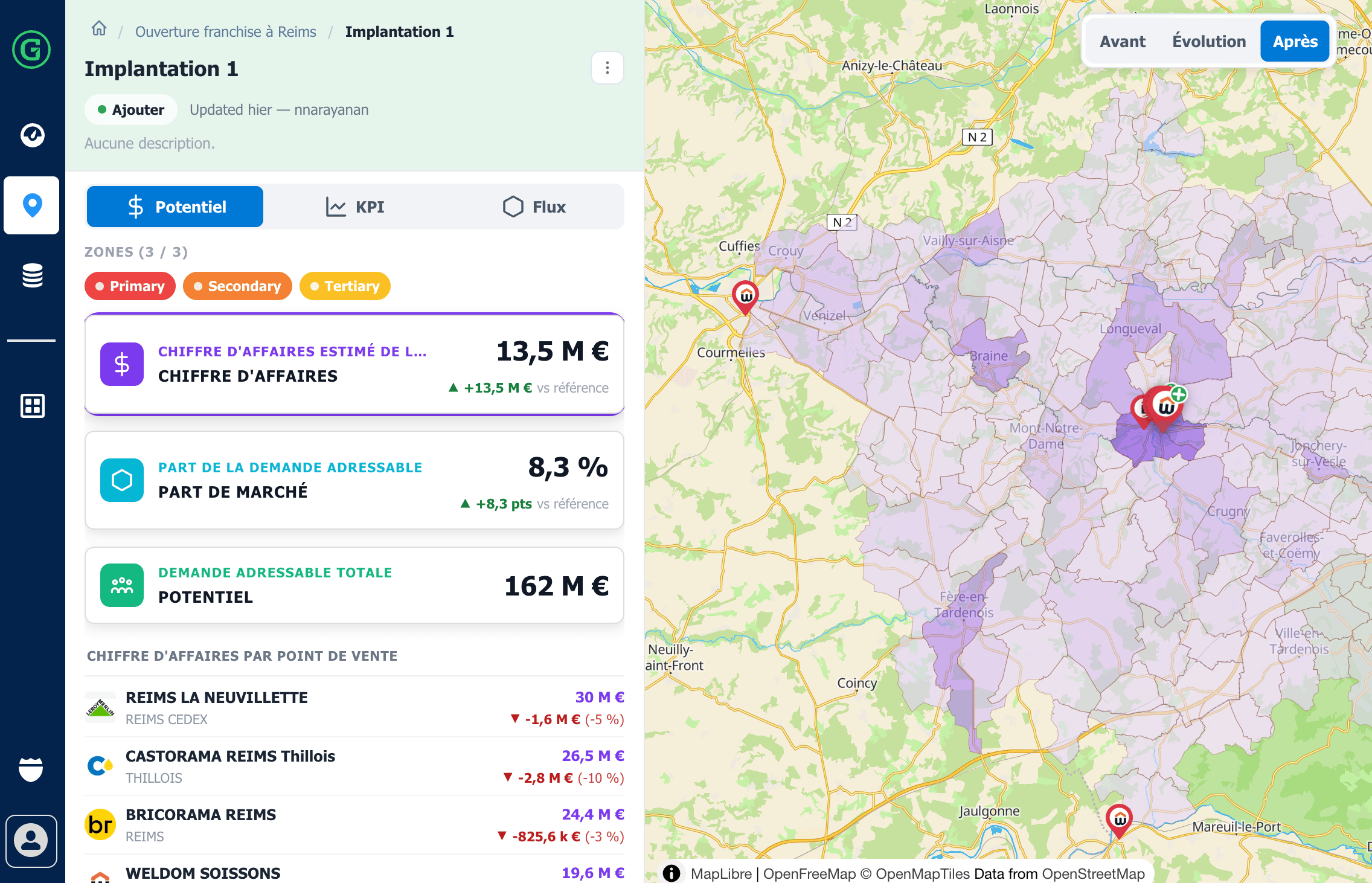
Line up two or three locations on a strictly identical basis. Density, foot traffic, competition, potential: the evidence speaks for itself, and the decision is based on facts rather than case-by-case judgment.
An opening should never be judged in isolation. Magellan recalculates the entire network and quantifies the difference: what the new site brings in, and what it takes from neighboring stores. (Go deeper: Cannibalization use case.)
Check the real potential, foot traffic, visibility, accessibility, not at the town level, but at the exact address.
Generate an elegant, clear, and shareable report that highlights the essential elements.
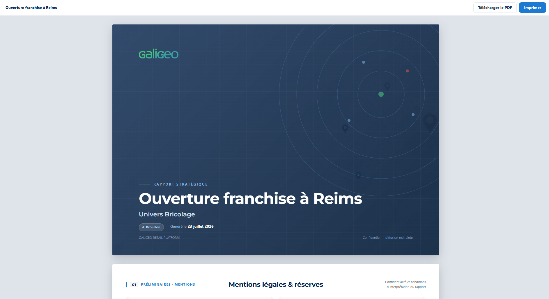
The report integrates the essential map visualizations for understanding the site:
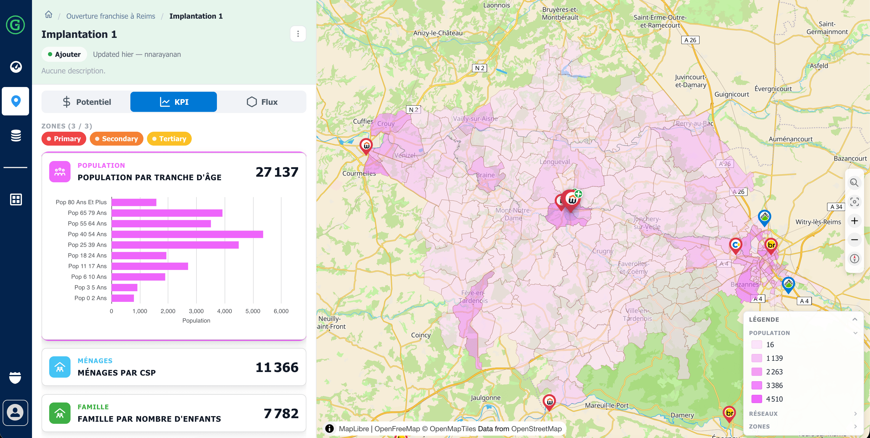
Consolidate at a glance the quantitative data that structure your decision:
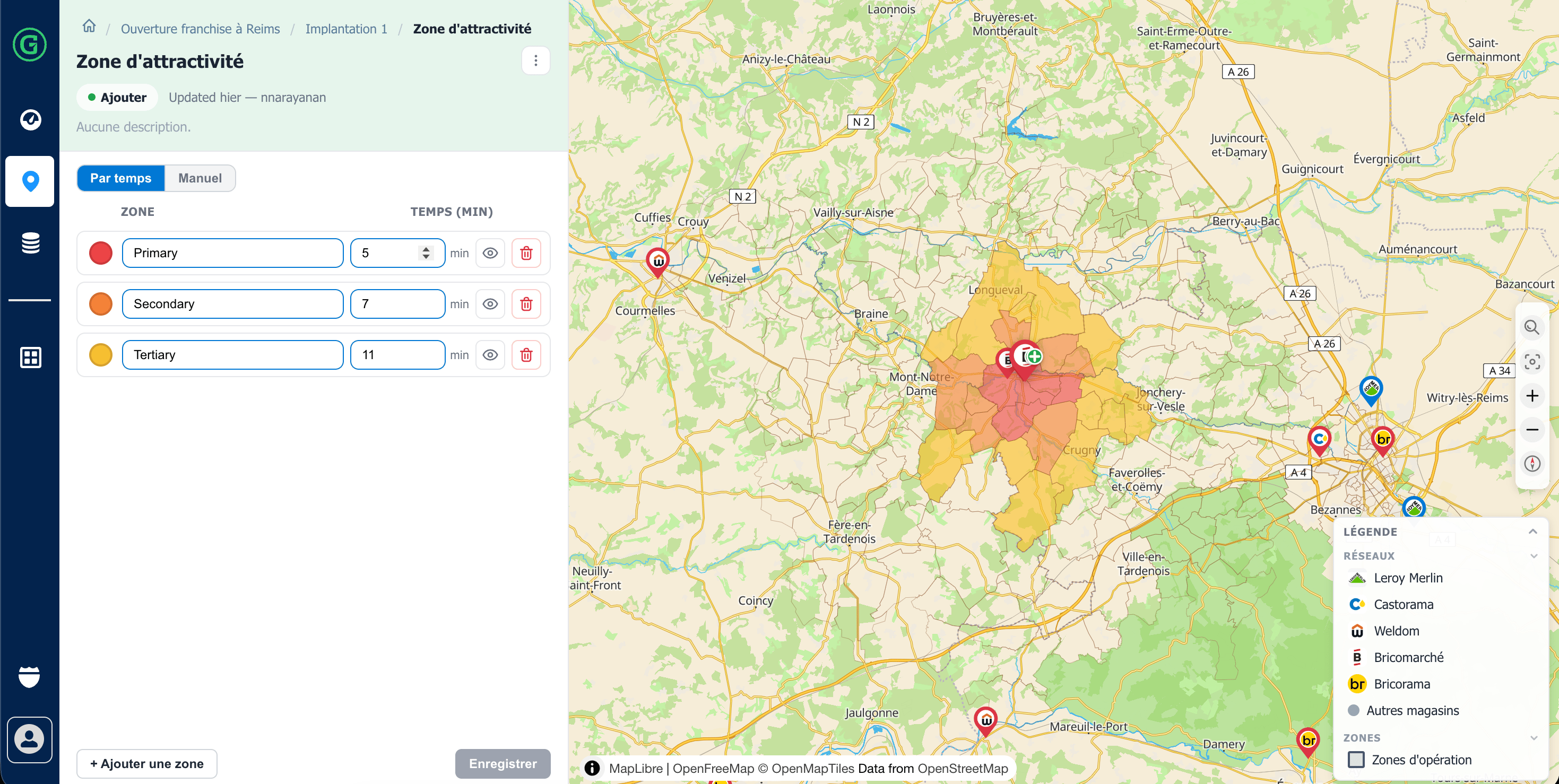
Get a precise and realistic representation of your future point of sale's captive territory, calculated using isochrones (travel time on foot, by car, or by public transit).
The trade area accounts for physical terrain barriers to reflect the actual mobility behavior of your potential customers.
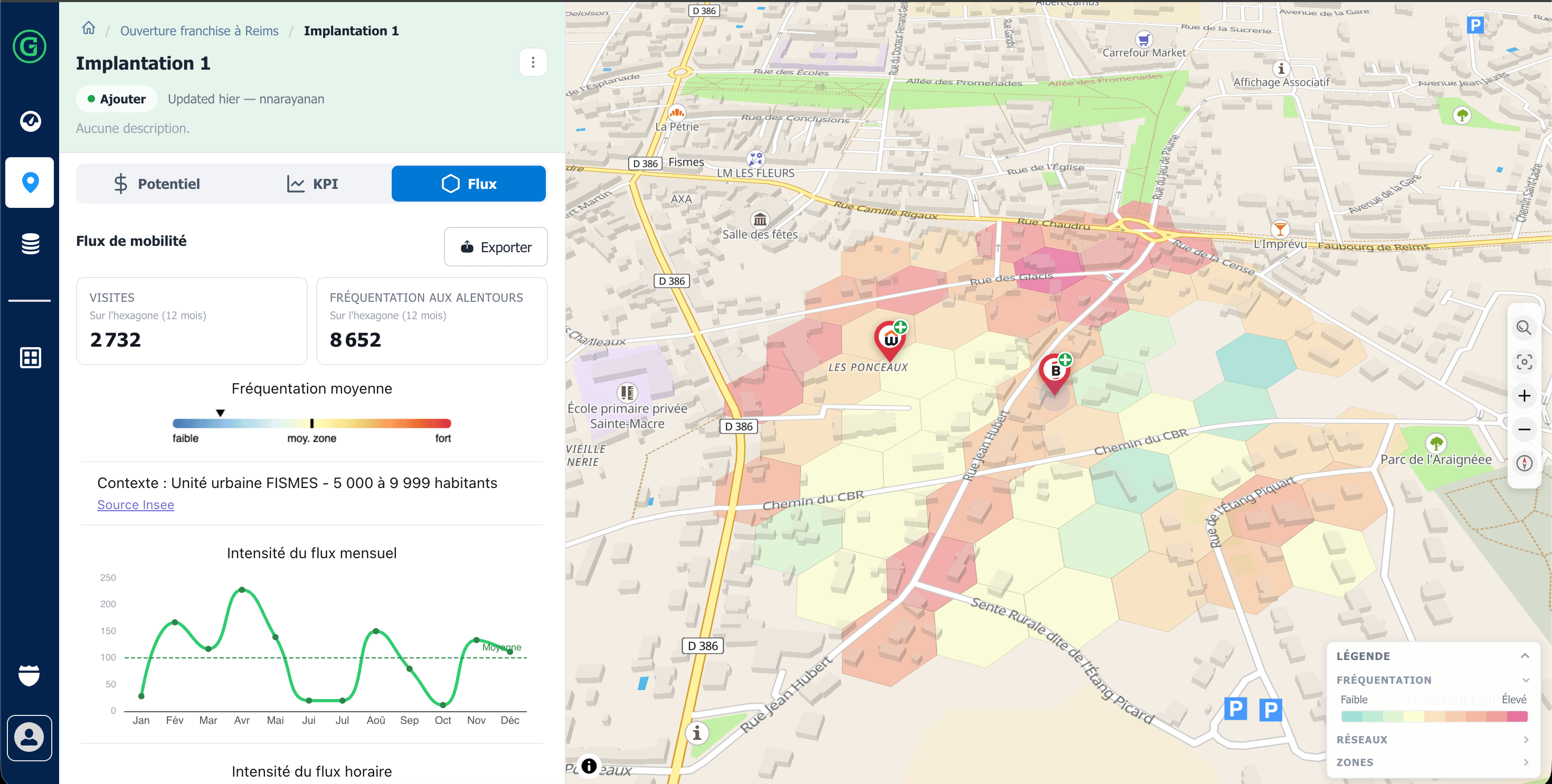
Visualize on a single screen the entire competitive landscape of the site, direct and indirect brands, overlap zones, combined with on-site measured pedestrian traffic data.
This dual perspective lets you simultaneously evaluate competitive pressure and the location's actual exposure potential.

- less pressure, - more confident decision-making, - a site story that's easy to tell.

- fewer site selection errors, - higher success rate for store openings, - faster and fairer decision-making.

- network consistency, - standardized analyses, - significant time savings.
Request a demo or explore a sample site selection report generated automatically.