Suivez nous :

G22 expands our ecosystem with pedestrian flow data, native Excel map integration, the DataHub featuring 350+ INSEE indicators, and new enterprise BI connectors.
Pedestrian Flow Data
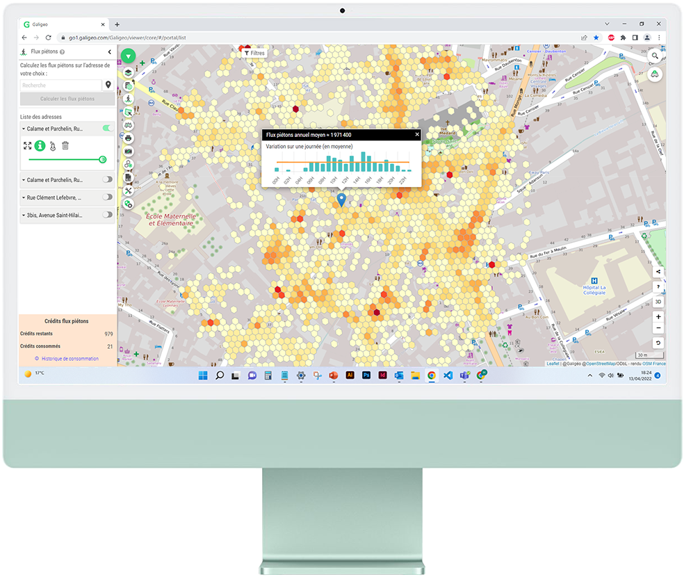
Site Viability Metrics: Evaluate the commercial potential of your locations using precise pedestrian footfall data. Leverage nationwide traffic metrics to de-risk your site selection and investment decisions.
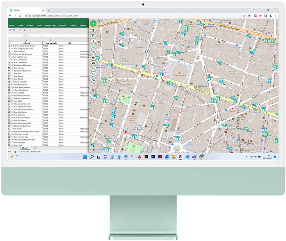
Report Integration
Embedded Mapping for Excel: Integrate an unlimited number of map views directly into your Excel documents. Enrich your spreadsheets with geographic visualizations that remain fully actionable within your reports.
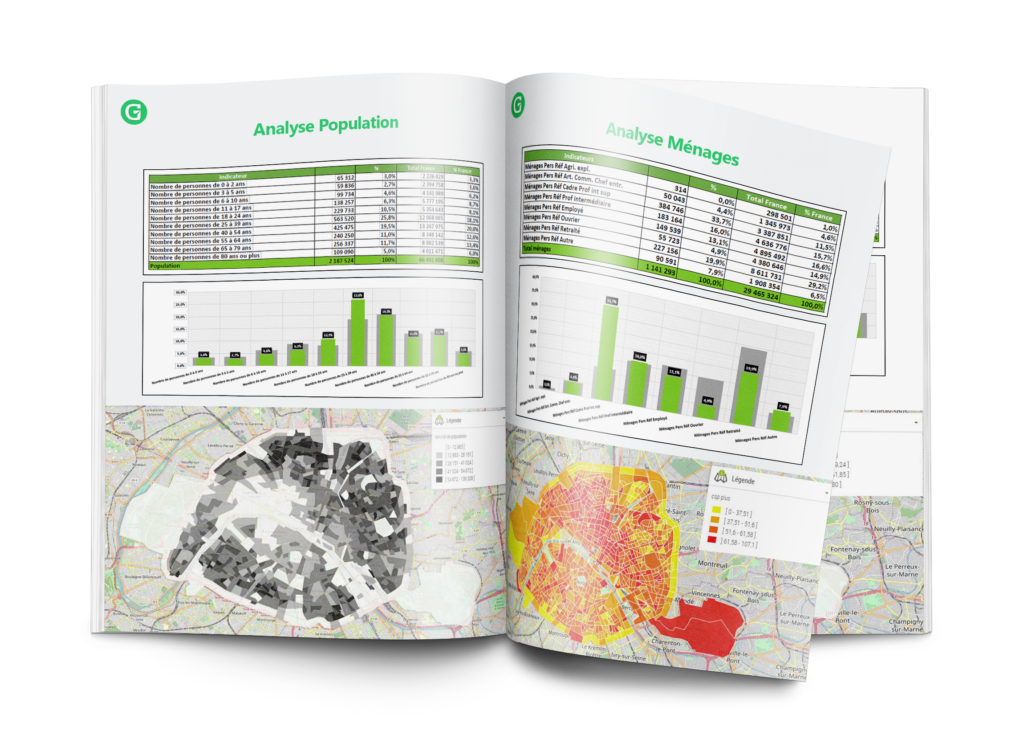
DataHub
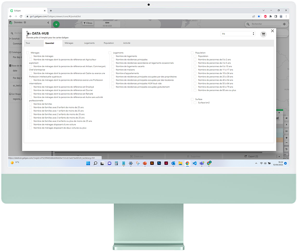
Instant Socio-Economic Insights: Gain immediate access to over 350 INSEE economic indicators at the departmental, municipal, and sub-municipal levels. High-quality socio-economic data, ready for immediate use in your spatial analysis.
Geocoding
Comprehensive Address Mapping: Free geocoding via data.gouv for Mainland France. The HERE Geocoder is also available as an integrated alternative for international addresses.
Information Factsheets
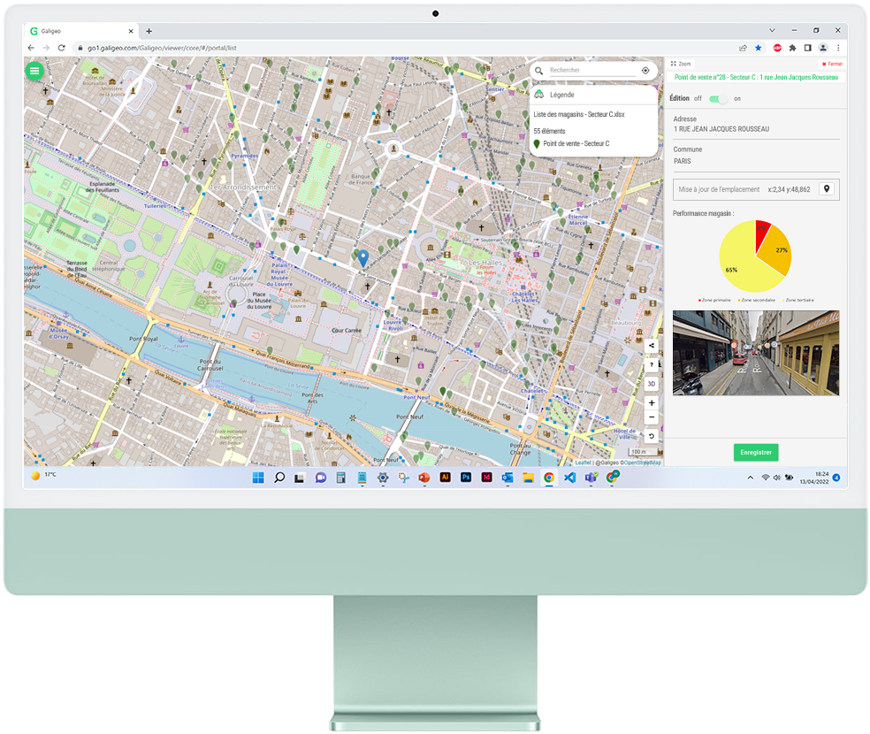
Interactive Site Management: View and edit location details directly on the map using enhanced, interactive factsheet overlays. Designed for more efficient field and asset management.
BI Connectors
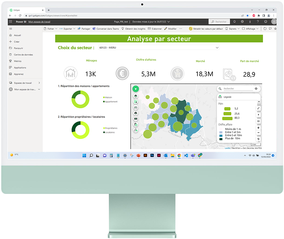
Enterprise Ecosystem Integration: Deploy Location Intelligence seamlessly within SAP Analytics Cloud, Qlik Sense, and Power BI. Native integration designed to enrich your existing decision-making dashboards.

Grégoire Delaporte