Suivez nous :

G19 transforms how you handle location intelligence. Featuring Map Manager, Theme Manager, and Query Builder, our new interface and filters make spatial analysis easier and more intuitive than ever.
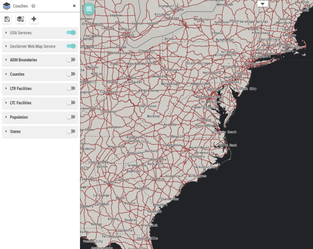
Map Manager

GIS Integration with Seamless Service Management: Manage geographic services from multiple sources, including Shapefile, ESRI, WMS, WFS, PostGIS, and Oracle. Directly access and administer your base maps and business layers.
Theme Manager
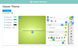
Interface Customization: Align the application’s look and feel with your corporate branding. An essential tool for improving user adoption and reinforcing your organization’s visual identity.
Query Builder
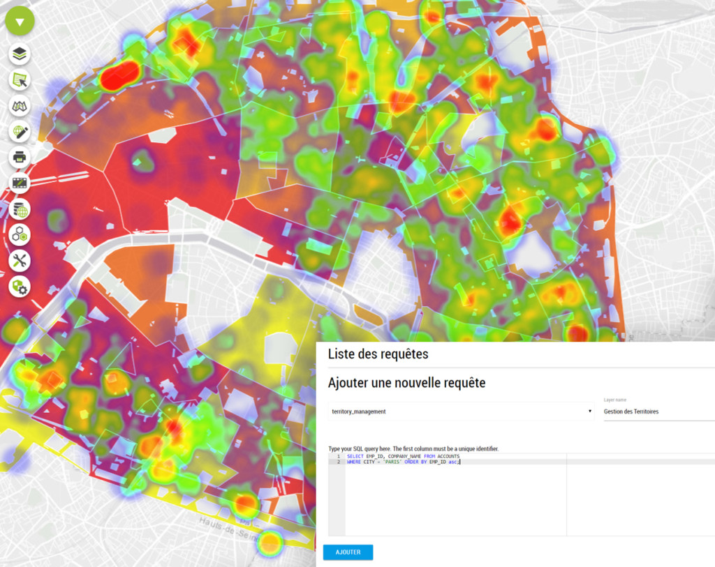
Direct Database Connectivity: Intuitive SQL query building for Oracle and PostGIS. Includes integrated syntax highlighting to streamline query writing and debugging.
Nouveaux filtres
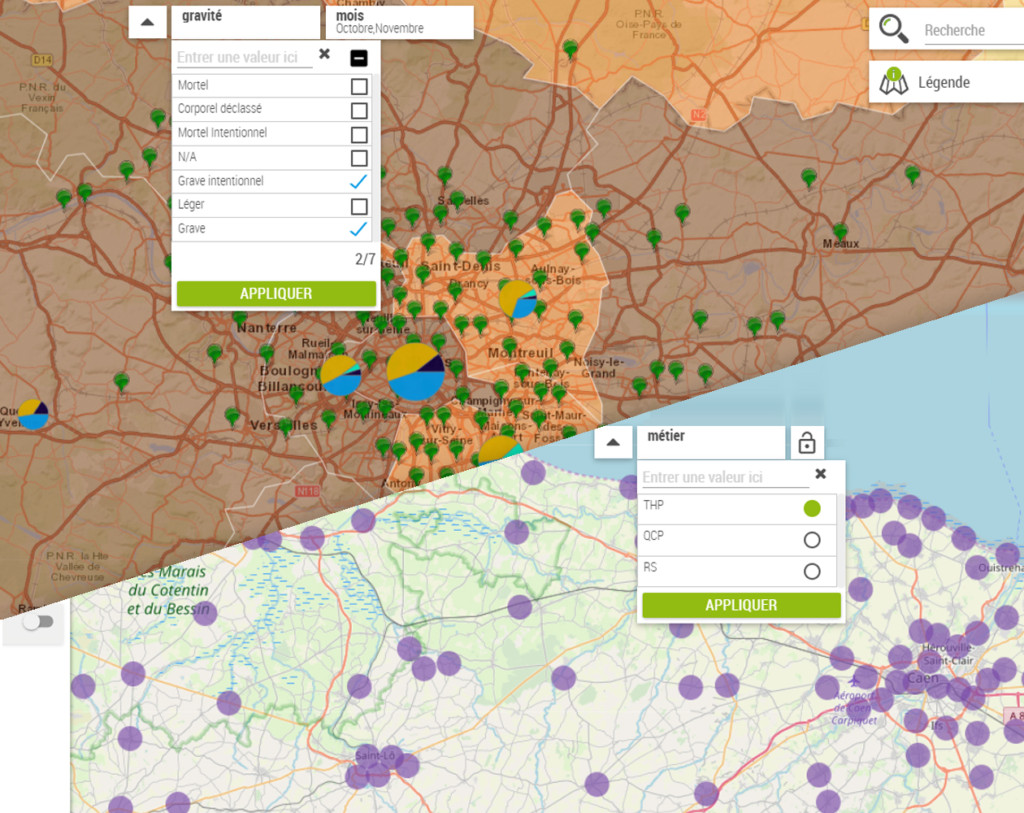
Multi-Source Data Filtering: Filter your data directly on the map from various sources. Features customizable filter types with multi-source capabilities for targeted and efficient analysis.
Segmentation dynamique
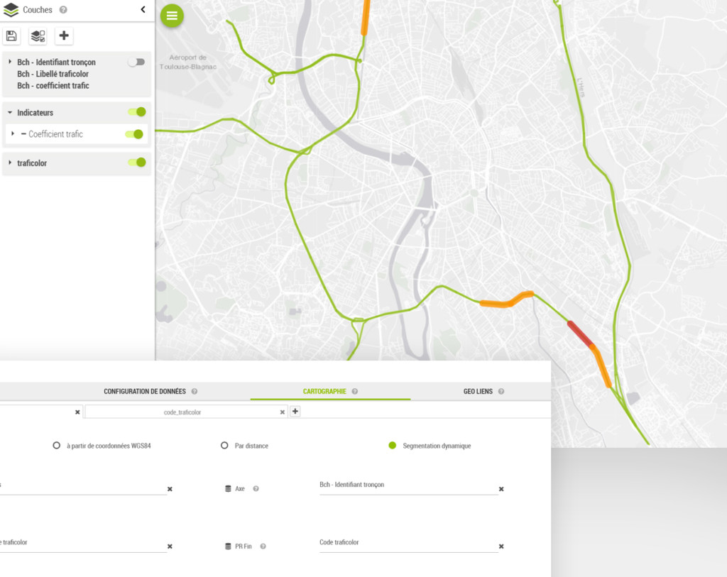
Linear Network Analysis: Analyze infrastructures such as roads, railways, and pipelines using milepost/kilometer-point (MP/KP) indicators. Ideal for infrastructure managers and network operators.
Gestionnaire de Territoires
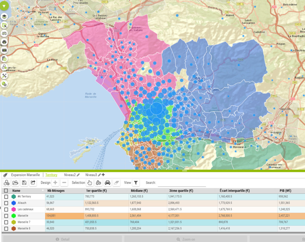
Simplified Project Management: Streamline the creation of sales territories and catchment areas. Includes automatic generation of territorial hierarchies for optimal organization.
Performance & UX
Speed & Responsiveness: Map loading times have been reduced by 30% to 40%. Eliminated unnecessary reloads to ensure a smoother, more reactive user experience.

Grégoire Delaporte