The current pandemic is a global crisis that impacts every government – Federal, National or Local – in every country, but that also requires adapted local solutions according to demographics, behaviors, geography or economics. Relying on consistent geolocated data on territories about the situation, needs, resources, material, people… is key for all persons involved in this fight. Location Analytics can help Governments and Public Sector Authorities involved in Healthcare, Law enforcement, Transport, Economics to better understand the situation and its evolution, to make the right decisions and improve execution.
To try to stop the virus from spreading, non-essential infrastructures are closed: daycare centers, schools, universities, mall centers, public swimming pools, …
The current lockdown, social distancing and economic hardship are painful: many have lost their jobs, are isolated and far from shopping and health facilities, some have no way to move around, … And alleviating that pain is precisely one major mission of Government Authorities, by protecting their citizens and making sure they can all have access to core services, especially during these uncertain times.
To help them going through this new and complex context, Governments and Authorities can leverage Location Analytics to extract additional insights from data by adding several layers of geolocalized information. Thus, they make sure each of their fellow citizens is safe, by following the evolution of the pandemic in real time, correlating it with all relevant socioeconomical indicators, at the relevant geographic levels.
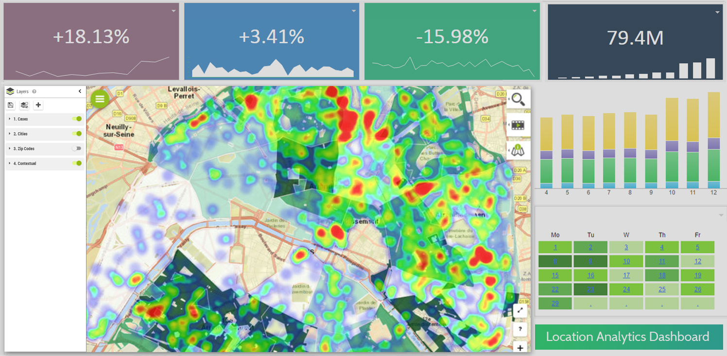
Detect and Monitor Areas at Risk
The location of each coronavirus infected and / or hospitalized person can be plotted on a map and shown as a heatmap, in order to rapidly identify “hot” areas that are the most at risk. A time attribute can also be leveraged to detect hidden trends through time, as shown below.
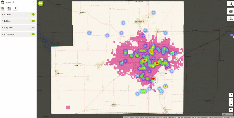
Creating and using this kind of geo-analysis can be done in self-service mode, using modern Location Analytics technologies.
Segment and Identify the Most Vulnerable Populations
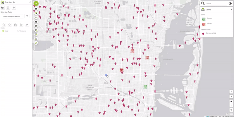
One of the major impacts of coronavirus is that almost all stores and mall centers have closed their doors, including local ones. Populations might then find themselves far from essential open stores. Some are carless, and left without the possibility to restock. Location Analytics makes it possible to identify and examine areas where these people live.
For instance, one can plot closed and open stores on a map, and extract populations beyond store range, by distance or drive time.
This allows Authorities to take actions needed to ensure these populations are not left unattended, by food supply, and exactly know where stores have to reopen.
Make data-backed decisions to offer the best “crisis” services
Schools are also closed, so kids and teenagers are permanently at home. The poorest households depended on school for their lunch. By displaying different socio economic indicators such as Number of Households or Average Revenue by Household at different geographic levels (State, Region, County, Zipcode, Postal Code, …), Public Authorities can get an overview of the areas where the poorest families live, and take preventive actions towards on their behalf.

The takeaways
The use of geolocalized data for Analytical purposes allows Governmental and Public Organizations, whatever their size, to make the right data backed decisions, at the right time, and thus offer the best care for their citizens, during emergencies or not.
Modern technologies and softwares are now mature enough to let every Data Analyst, BI user or even Business user crunch these geolocalized data, analyze it and find solutions from it, without being an expert in geomapping or GIS.
Location Analytics can be leverage in many ways, such as Cloud Platforms, or directly leveraged within existing IT and BI environments, like SAP, IBM or Microsoft.
Stay safe, and take care of your family and communities.